

CoreScan3 and CoreScan UV
The CoreScan3 and CoreScan UV are powerful methods for detailed analysis of drill cores, providing valuable data for geological, geotechnical, and mining investigations.
CoreScan3
The CoreScan3 enables highly precise, three-dimensional capture of the core surface. This allows for structural analyses, identification of fractures and stratifications, and automatic calculation of RQD (Rock Quality Designation) values. A particular advantage is the digital reorientation of the drill cores when optical borehole logs are available, allowing their original orientation to be accurately reconstructed. Additionally, the high-resolution 3D models enable the long-term archiving of core data for subsequent reanalysis. > More Information
Facts
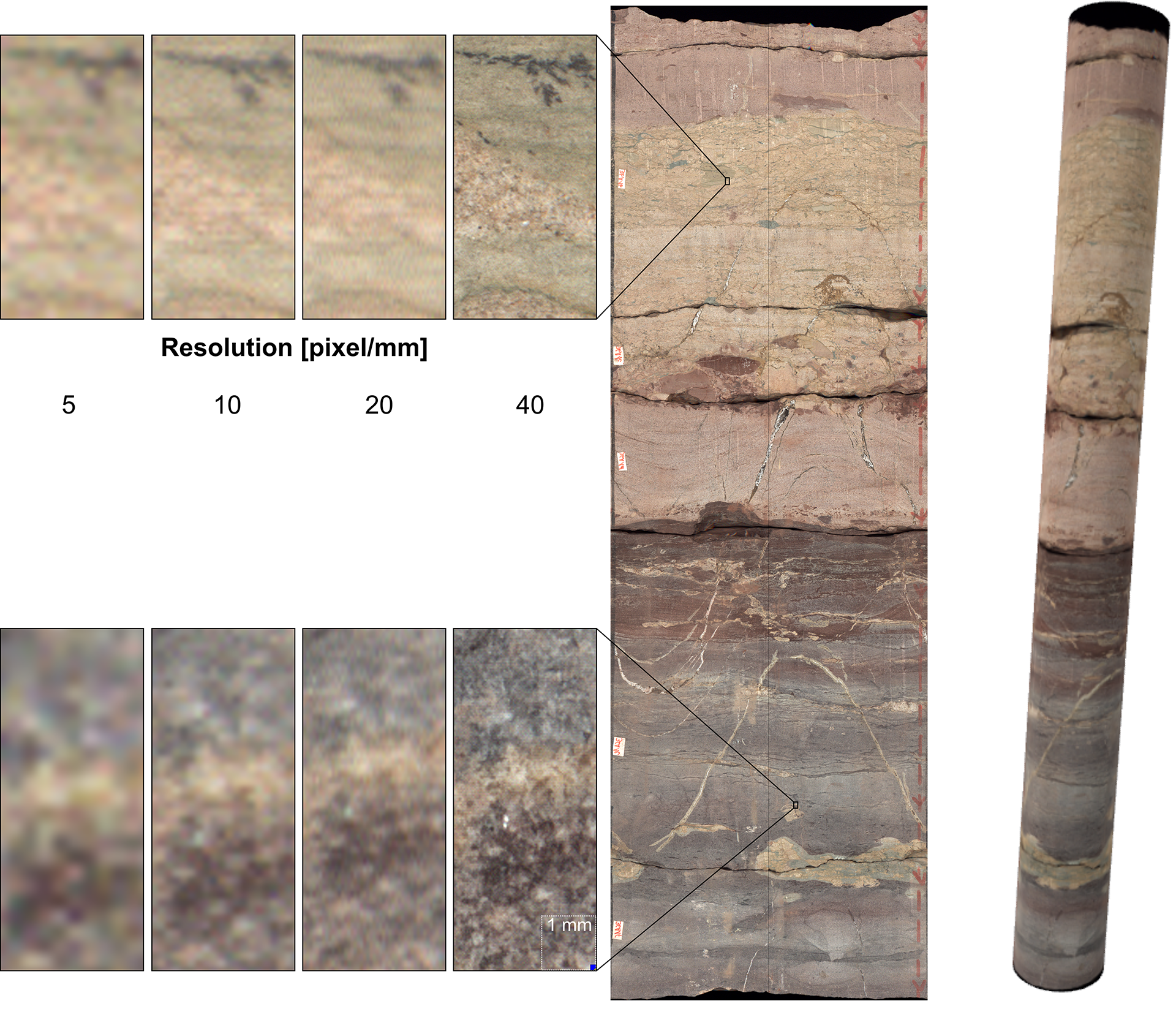
- Core Boxes slabbed and 360° images in high-resolution
- Core length: up to 1 m (full 3D and slabbed Cores)
- Core diameter: 25 to 150 mm (unrolled), up to 250 mm (slabbed)
- Resolution: 5, 10, 20 and 40 pixel/mm
- .DMT file (.xml format) for integration into databases (e.g. CoreBase)
- Image File Format: .png, .tif, .bmp, .jpg
- .obj + .mtl for integration into CAD Systems and 3D preview (only unrolled)
- Units:
Length: Meters, Foot, Inch
Angles: Degree, Rad, Gon
CoreScan UV
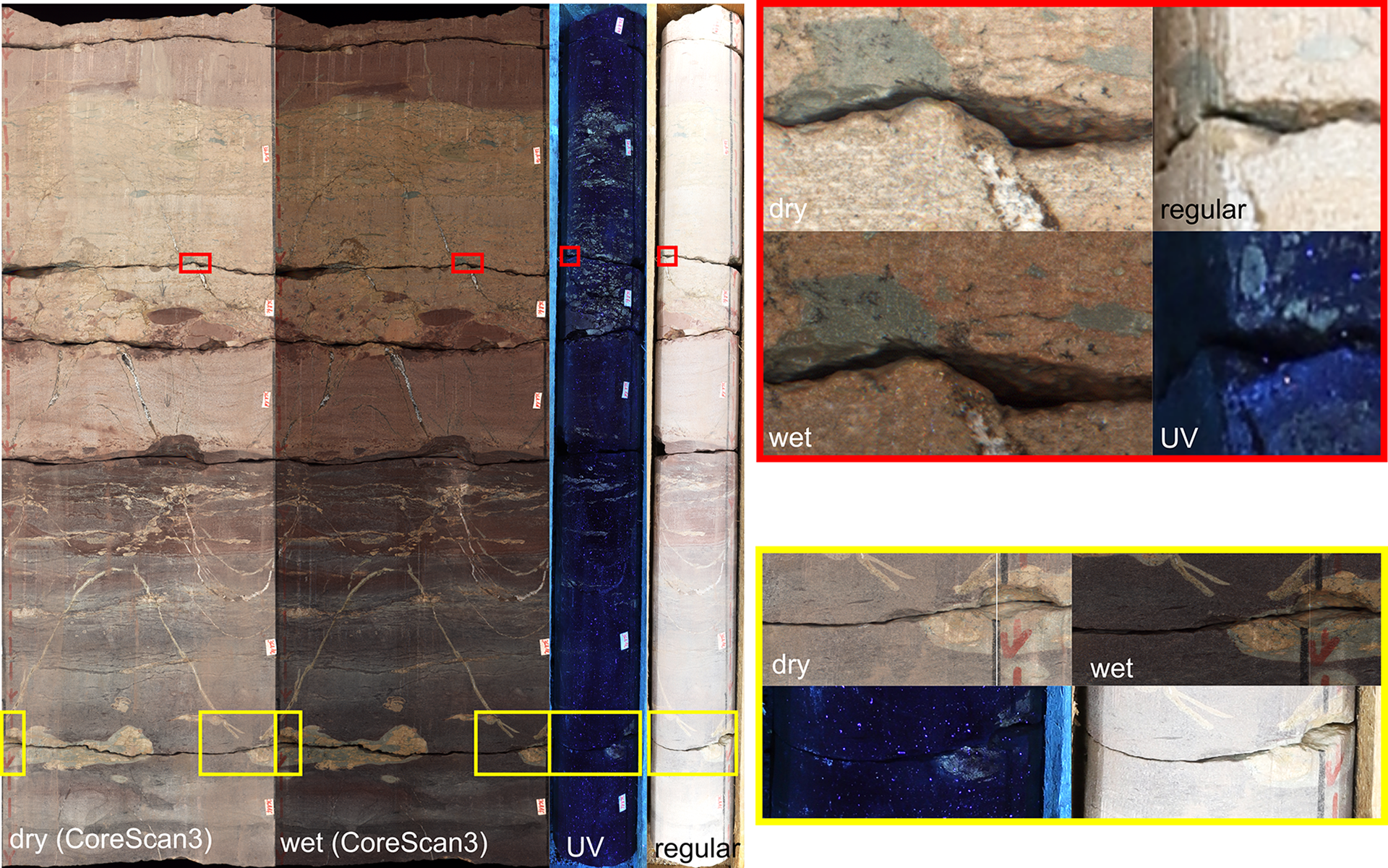
The CoreScan UV complements these examinations by using fluorescence analysis to visualise subtle material differences that are not visible in normal light. This allows for detailed identification of mineral phases, detection of organic material (e.g. oil), highlighting of fractures and pore spaces, and improved structural recognition. Especially in combination with the CoreScan3, this method provides deep insights into the characteristics of the rock. > More Information
- Core box dimensions: up to 1.15 x 0.64 m
- Core length: up to 1.05 m
- Resolution: 8.688 x 5.792 pixel
- 0–100% mixing of white and UV light images
- .DMT file (.xml format) for integration into databases (e.g. CoreBase)
- Image File Format: .png, .tif, .bmp, .jpg
- Units:
Length: Meters, Foot, Inch
Angles: Degree, Rad, Gon
The obtained data provide a solid basis for geological modeling, simulation of rock stability, and optimization of exploration strategies. Additionally, they enable complete documentation and archiving of drill cores, allowing for easy comparisons and reanalysis later on. With these modern scanning technologies, decisions in geology, engineering, and mining can be made more informed and efficient.