

Computational Geodynamics for Hazard Assessment
Research Focus
In Computational Geodynamics we focus on:
TECTONIC STRESS & SEISMICITY 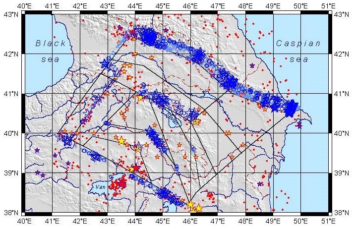
Nonlinear block-and-fault dynamics of the lithosphere and earthquakes. Tectonic stress analysis and modeling. Seismic hazard and risk assessment. Applications: Caucasus, Tibet-Himalayan, SE-Carpathians (Vrancea), Apennines.
VOLCANIC FLOWS 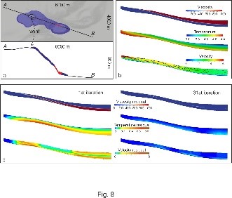
Reconstruction of thermal and dynamic characteristics of volcanic lava from surface thermal measurements. Numerical modelling of lava flow with a ruptured crust. Two- and three-dimensional time-dependent and steady state modeling.
MANTLE DYNAMICS 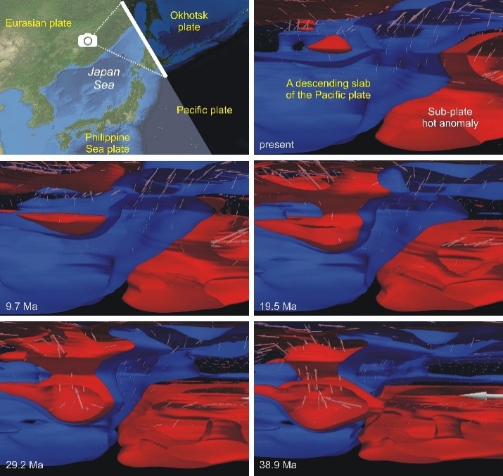
Thermal plume evolution. Mantle-lithosphere interaction. Lithosphere-asthenosphere delamination. Continental collision. Pacific plate subduction and its evolution.
SEDIMENTARY BASINS 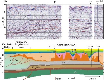
Mechanisms of basin evolution. Geothermal evolution. Salt tectonics and dynamic reconstruction of salt structures. Link between mantle dynamics and basin evolution. Application: North American, East European, and Siberian basins; Pricaspian salt basin and Gulf of Mexico.
COMPUTATIONAL GEODYNAMICS & METHODS 
Development of methodology and software for geodynamic modeling using finite element methods, finite difference methods, finite volume methods, direct and inverse methods. Data assimilation. Data-driven numerical modeling.
RISK AND SUSTAINABILITY 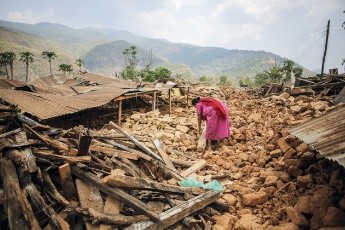
Studies of related to disaster risk reduction, risk assessment, preparedness, and the role of science in risk reduction. Science policy and diplomacy. History of Earth and space sciences.