

Unravelling the Areas Prone to Large Earthquakes in the Caucasian Region
- Contact:
A. Ismail-Zadeh
- Funding:
Deutsche Forschungsgemeinschaft (DFG)
- Partner:
A. Gorshkov (Russian Academy of Sciences, Moscow, Russion)
- Startdate:
2016
- Enddate:
2019
Dynamics of the lithosphere in the Caucasian region is manifested in the surface as large earthquakes. The research is focused on a challenging problem: how to identify the areas prone to large seismic events in the region? The fundamental goal of the project is to contribute to mitigation of potential earthquake disasters. The goal will be achieved by using geophysical, geological, geodetic, and other data available for Caucasus and by employing the existing and new methodologies developed within the framework of the proposed project. The project (i) identifies a hierarchical block-structure of the Caucasian region by the morphostructural zoning method and mapping of specific earthquake-controlling structures; (ii) evaluates seismic potential of the mapped nodes employing artificial intelligence methods and topographic-geophysical criteria of high seismicity; (iii) analyses seismic events using earthquake simulation models and to map large synthetic seismic events along a regional fault structure; and (iv) develops an advanced computational methodology for modelling and forecasting of possible locations of large seismic events in regions of high-to-moderate background seismicity. Using a quantitative approach we expect to receive the results related to possible locations of large seismic in Caucasus for the period of several thousand years. This will provide a significant improvement of seismic hazards assessment in the region which will be based on simulated seismicity. The broader impact of the proposed activity includes (a) better fundamental understanding of interplay between lithosphere dynamics, fault interaction, and associated extreme seismicity; (b) developing an enhanced methodology for simulation of extreme seismicity to be used by the seismological community; and (c) increasing the arsenal of models for the study of dynamics of lithosphere and seismic hazards. Project results could be used in comprehensive seismic hazard and risk assessment, and it will be hence related to public safety and disaster risk reduction.
 |
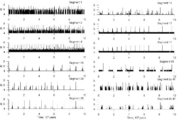 |
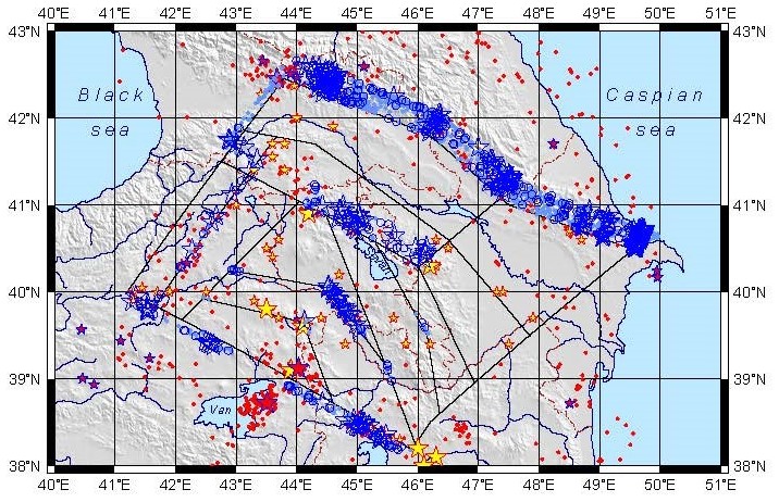
| Distribution of synthetic seismicity imposed on the map of observed seismicity: blue stars mark earthquakes of magnitude М7+, blue circles М6.5+ events, and light blue dots М6+ events. | Synthetic earthquake magnitudes versus time for individual fault segments. (Figures from Vorobieva and Ismail-Zadeh, 2019). |